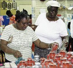
Phyliss Bennett (left) and Monica Donaldson, both of Clark's Town, Trelawny, shopping for lanterns and other essential items in preparation for Gustav, at Azan's Supercentre in Cross Roads, St Andrew, yesterday. - Junior Dowie/Staff Photographer
A crawling Tropical Storm Gustav kept Jamaicans on the edge yesterday as it continued on a path that would put it between Jamaica and Cuba by late this afternoon.
The slow pace of the system left most Jamaicans in limbo, as projections changed almost by the hour as to when the island would begin to feel the effects of the seventh tropical storm of the current Atlantic hurricane season.
Gustav was initially projected to pass Jamaica late last night or early this morning, but after slamming into Haiti the system lost strength, moving from a Category One hurricane to a strong tropical storm.
The system also lost some pace and reduced the speed of its dangerous trek across the Caribbean from 11 kilometres, or seven miles per hour, to six kilometres, or three miles per hour.
That was expected to change last night, with forecasters projecting that Gustav could regain hurricane strength over the next two days.
Heavy rains
Up to late yesterday forecasters were projecting that the island would experience rainfall of between six and 12 inches, with some areas getting as much as 25 inches.
That could lead to flooding in several communities, particularly low-lying areas on the northeastern coast.
A hurricane watch and tropical storm warning remained in effect for the island last night as the Met Service continued to urge Jamaicans to brace for bad weather.


